Exploring Kangaroo Island Map
EXCLUSIVE BENEFITS ◆ BEST RATE GUARANTEE WHEN YOU BOOK DIRECT ◆ ONLY ON THIS WEBSITE
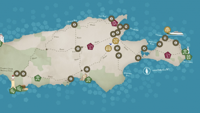
Exploring Kangaroo Island by car is a wonderful way to travel the 1,600 km of roads which will take you through the major townships. Expect the majority of our main roads to be sealed, principally those linking Penneshaw, American River, Kingscote, Parndana and Flinders Chase National Park.
If you are planning to go bush, you will likely travel on unsealed roads, leading you to tucked away beaches, natural wildlife habitats and truly special destinations.
Kangaroo Island Tourism has a fabulous digital map where you can discover food, beverage and attractions. You will also find events, opening hours and specials that may be running at the time of your travel. You will be able to create an itinerary on the interactive map as well as selecting a pre made itinerary.
*Photo credits : Tourism Australia


